Category Archives: Soils

Critical Habitats in Connecticut

Introduction

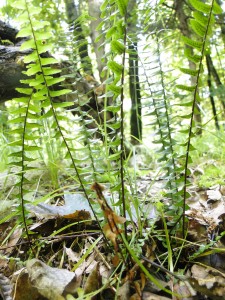
Ebony spleenwort, characteristic of rocky ridgetop critical habitats, regardless of the type of bedrock.

I am often asked, just what is a critical habitat, and is it protected or not?   My answer is drawn from  a hybrid  DEEP document  (map plus explanations and keys)  called “Critical Habitats” last revised in 2011.  Recently retired DEEP plant ecologist,  Kenneth Metzler wrote: “these habitat types have a long history of conservation interest and have been documented and studied as being among the most rare, unique, and threatened, habitats in the state.”    Critical habitats support uncommon ecological communities, because their geology, soils, and/or hydrology are distinctive, which also confers scientific, educational and heritage value.  They each  support a characteristic and unique suite of plant and animal species.   25  upland critical habitats were  identified in the Connecticut Comprehensive Wildlife Conservation Strategy (CWCS)The intent of the DEEP document is to help towns with their conservation planning –  not to ban development  of all critical habitats,  but  as a planning tool, to prioritize open space protection initiatives, in conjunction with other conservation planning principles:  minimize habitat fragmentation, and maximize the size and ecological integrity of protected tracts. www.cteco.uconn.edu is the URL.

State statute does include protections for endangered and threatened species. Critical habitats are a good deal  more likely than the average field or woodlot to include state-listed species (Endangered, Threatened, and Species of Special Concern.)   Each critical habitat also has many other unusual plants and animals that don’t quite “make the cut” for  Connecticut’s List – pitcher plant in a Black Spruce Bog, for example.

Also expected in a critical habitat are rare species among the understudied life forms like lichens, mosses, and soil microbes.  These life forms are simply missing from the Connecticut Natural Diversity Database (NDDB) lists.

 Potential rare species are likely to be missed by a targeted search for one or two species, especially because they are readily detected during a  short window. Plant seeds may lie dormant in the seed bank, sprouting only in certain years.   Many small plants are usually overlooked, even by botanists, except during a brief window when they are in bloom. Most insects, including butterflies and moths, are detectable only for a brief portion of the year. Rather than doing exhaustive, specialized  searches, it is less expensive and simpler, to determine whether the expected suite of diverse, characteristic plant species is present, and if it is, to protect the critical habitat.

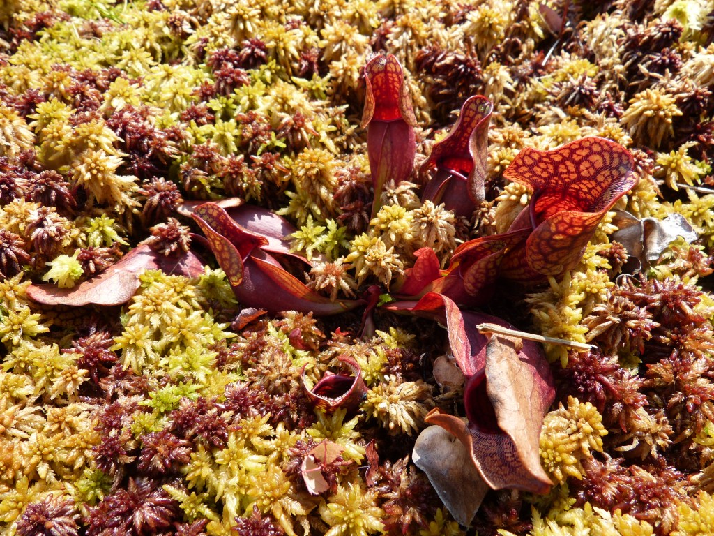
For example, we  assessed a pristine black spruce/white cedar/ sphagnum bog recently, with hundreds of pitcher plants.  The targeted listed species are insects that feed on pitcher plant; we are recommending conservation of the whole bog with a wide buffer, with no need for a search for the tiny rare insects.

A bog in Canterbury has 100’s of of pitcher plants, and land use boards fully understand that this critical habitat, and must be fully protected.; the biodiversity value of rocky outcrops is less widely understood.


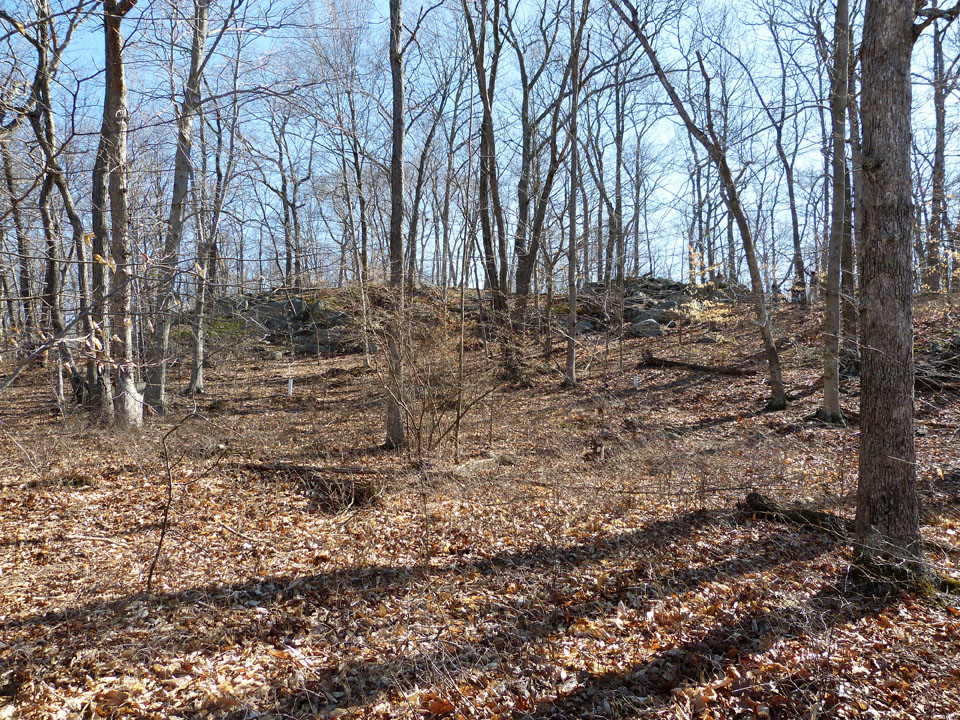
Bedrock outcrop in Essex. A full inventory of the hilltop plant community is not possible outside the growing season. We recommended including  the entire hilltop  in the  open space portion of the subdivision.


Planning Considerations

The “critical habitat” label is a flag for land use planners  to commission  a thorough inventory and to search for rare, state-listed  species in multiple seasons, before the area  is developed, and if possible over a several year period.  Critical habitat status alerts planning boards  that a property  is likely to be a desirable, interesting  destination for recreation,  and a potential site for nature study and/or scientific investigations.   Trails, towers, boardwalks, maps, and informative web sites can enhance these human values.  Excessive human use may degrade them, but more often they are protected by human intervention,  such as invasive plant  control or occasional tree-trimming to maintain an open critical habitat.  Public education on a critical habitat helps with its long term protection.

Some critical habitats, like black spruce bogs and white cedar swamps,  are so  unusual that their  status is widely understood and accepted, and they also have the  protection of being wetlands. The special status of other critical habitats is much less widely understood.  As a botanist, I am most familiar with three largely overlooked critical habitats:

1)  The group of plant communities on soils derived from traprock or  limestone (subacidic/neutral and  mineral-rich),   including  glades, dry forests, and summit shrublands;  and

2) Outcroppings, ledges, cliffs, and rocky, open  summits, with pockets of mineral-rich soil.  These are defined as critical habitats in the ECO key, regardless of bedrock type.

3) The rich floodplains of larger rivers;

The status of these less well known critical habitats is not widely understood by regulators, natural resource professionals, and the general public; as explained above,  official DEEP Critical Habitat status does not confer protection from development or quarrying, unless the areas are demonstrated  to support Endangered or Threatened species.  However, CTDEEP typically requires a survey for rare species by an expert, if a development site includes a known critical habitat.  Floodplains are protected, but the main reason is avoidance of flood damage.  Protection for privately owned rocky knolls and summits is still lacking in most town zoning regulations, despite official DEEP Critical Habitat status.

For the volcanic traprock ridges and certain ridges with amphibolite minerals, there exists already a model ridgeline protection ordinance, based on a CT Statute (Sections 8-1aa and  8-2 c), incorporated into the zoning regulations of some towns.  This ordinance applies only to the more  dramatic, high ridges, though low ridges, if reasonably undegraded by man, also include critical habitats with characteristic and unusual traprock  geology, botany, and fauna.

Zoning regulations can also be amended  to protect better natural features meeting certain criteria with value for the community as a whole:  heritage value, outstanding aesthetics,  or  historic, scientific, and/or educational interest.  Protection of these natural features  can also be a goal guiding open space acquisition activities by municipalities, the state, and private land trusts.  However, consistent with the Connecticut Comprehensive Wildlife Strategy, the long term welfare of the fauna and flora will better served by one sizable (e.g. over 100 acres) preserve with a few critical habitat pockets, than by multiple critical habitat pockets (rock outcrops) in a matrix of small woodlots and development.

History of the “Critical Habitat:  Concept

DEEP has been refining its list of “Critical Habitats,” for many years, building off those identified by Joseph Dowhan and Bob Craig in Rare and Endangered Species of Connecticut and their Habitats (1976), with descriptions of all of the State’s Ecoregions (DEEP Natural Resources Center  Report of Investigations No. 6.)  My associate, George, and I have referred to this red book so much in our ecological consulting work, that both our copies are tattered.

For over a decade, natural resource professionals cited the List of 13 Imperiled Habitats developed by Ken Metzler of CTDEEP and David Wagner of the University of Connecticut at Storrs.  It includes one difficult-to-map habitat:  “headwaters springs and seeps”   that is not on the current DEEP critical habitat map key, although it is a fragile habitat for multiple rare and uncommon species, and crucial for the health of larger streams and rivers.  Better consistency is needed between the Imperiled Habitats List and the new CT ECO document.

The current CT ECO  (Connecticut Environmental Conditions On-line) classification system  includes a map showing the larger critical habitat units, and also a key with detailed  definitions of each critical habitat. Since the scale of the map is such that most occurrences are omitted and since much of the state has not yet been surveyed, the introduction and the key are  actually the most important parts of the document.  

A fine introduction  is Dr. Robert Craig’s  book Great Day Trips to Connecticut Critical Habitats (2004),  which is available, used, on line.  This readable book is a guide to actual examples of fascinating critical habitats, accessible to the general pubic, with much thoughtful, scientific explanation.    Foremost a bird expert, Bob Craig  now runs  Bird Conservation Research, Inc., a non-profit in Eastern Connecticut.  I knew him twenty years ago  in grad school at the University of Connecticut at Storrs.

Scale Considerations

The group of critical habitats  associated with The Metacomet  traprock ridges occupies a tiny fraction of the state of Connecticut, but is nevertheless  extensive enough to support large metapopulations of both common and uncommon plants and animals.   The river floodplain habitats are  include  unusually large critical habitats, ecologically and genetically linked by flowing water.

I keep encountering morphologically distinctive plant varieties in these critical habitats, and realize that genetic variability also encompasses unseen metabolic characteristics, that will help plants adapt to ecological change. A  gene pool with hundreds or preferably thousands of individuals is needed for a good prognosis for long term survival in the face of climate change and other disturbances.

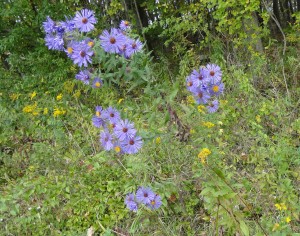
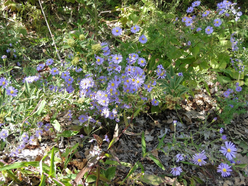
Horticultural and landscaping potential and even potential for medicinal use are other reasons to preserve the botanical biodiversity in critical habitats.  For example, the  smooth aster variety shown below (Symphiotrichum laevis)  is  bushy & colorful, and tolerates a dry, rocky site on West Peak of Meriden’s Hanging Hills. It is a lovely and ornamental perennial wildflower, and would be well suited to xeriscaping.

Impressive data for many traprock taxa has been collected as part of development applications,  such as  the gas plant application on Cathole Mountain  in 1999. The Connecticut Botanical Society and the local bird clubs have  long term data from many field trips to subacidic and rocky  critical habitats.

Glade habitat on West Peak of the Hanging Hills, in Meriden, June 2011. The grassy “lawn” is Pennsylvania sedge, and the flower is smooth rock cress, the food for the caterpillar of the endangered orange falcate butterfly. Hop hornbean, a typical glade tree, of subacidic, mineral-rich soils, at left. A talus slope is in the background.

The complex of critical habitats on the Metacomet traprock ridges has large populations of characteristic species like ebony spleenwort, bottlebrush grass, dwarf saxifrage, and hop hornbeam.  They are not Endangered or Threatened species, protected by state statute,  but are still species that are scarce  in the surrounding, fragmented suburban landscape.  Other species like Eastern box turtle and Ribbon snake,  are listed as Species of Special Concern,  such that CTDEEP can require searches and management plans, but  cannot prohibit habitat development.  Similarly clusters of crystalline bedrock outcrops in several sizable forested tracts along the Connecticut coast (including “The Preserve”  in Essex and Old Saybrook) also support robust populations of Special Concern reptiles,   and metapopulations of  uncommon, rocky-site  plant species like smooth foxglove and orange-fruited horse gentian.  Along river floodplains, flowing water and waterfowl  disperse seeds and link small stands of rare and uncommon plants, like  Davis’ sedge,  into larger genetic metapopulations.

For some taxa, a critical habitat need not be large and continuous so long as other examples are within dispersal distances for  seeds, pollen, moths,   etc.  Such a parcel of critical habitat is still part of the overall unit, from a genetic standpoint. The on-line CT ECO map includes the large, contiguous well-known examples of critical habitats.  Many other smaller examples are also worthy of study and protection, if they have not been severely degraded by invasive species or past farming.

Critical Habitats  that lie within a much larger matrix of natural habitat are especially valuable from an overall  wildlife conservation standpoint, especially for forest birds, large mammals,  and for vernal pool amphibians. Example are the summits of Connecticut’s  northwest hills;  the extensive rugged forests with many bedrock outcrops in the undeveloped parts of Essex and Old Saybrook; and Cathole Mountain; and the Silvio Conte wildlife Refuge along the Connecticut River.   The lower forested slopes of traprock and limestone ridges are not critical habitats,  but they greatly increase the width and size of the habitat blocks.  They also help protect the critical habitats along the ridge lines from colonization by invasive plant species.  For example, the large, latent Summerlin Trails residential project on Cathole Mountain, as initially conceived, would avoid the upper ridge crests and critical habitat areas, but would much reduce the size of the overall habitat block,  with potential to harm  vernal pool species and area-sensitive  forest bird populations.

Potential Outreach

Ample interesting material is available for outreach on critical habitats.  A newspaper article or radio program could use examples  of success stories,  like Hubbard Park in Meriden and Quinnipiac State Park along  the floo0dplain of the Quinnipiac River;  of dramatic battles, like that over development of a  pristine section of Cathole Ridge off Kensington Road in Berlin and of Cedar Ridge in Newington with outcome still unclear;  and of destruction  like the  mined section of Corporate Ridge in Rocky Hill.  Media outreach could revisit the volcanic geologic history, and past dramas, like the story of the now-defunct gas powered plant on Cathole Mountain in Meriden.  It could remind the public and the land use boards of the successful campaign, led by Norm Zimmer in the 1990’s,  for a Ridge Protection Compact.
 

Rich and Poor in the Plant World – Part 1

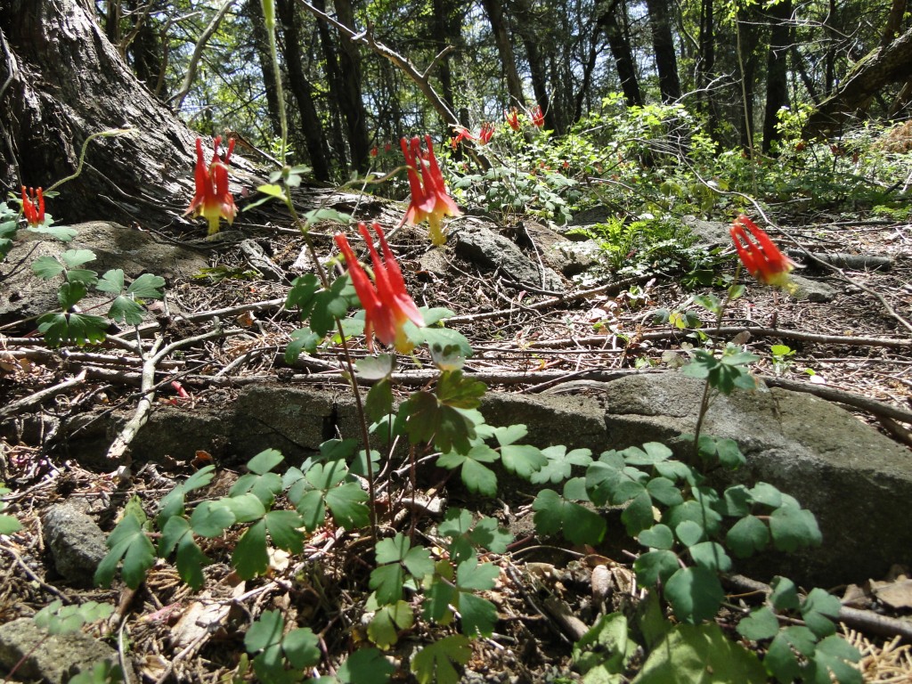
Red columbine grows in mineral -rich soil on rocky outcroppings. This thriving population was identified in Rocky Hill, at a site to become a shopping center. The plan was adjusted to preserve most of the knoll, not grade it away.

My much-loved,  old, heavy botanical manuals (e.g. Fernald and Britton and Brown)  always include a sentence or two about the habitat where a plant is found, as well as exceedingly detailed morphological descriptions.  “Found in rich soil” is a frequent description that can apply to fallow farmland, alluvial  floodplains, a bouldery forest at the base of a hillside,  or  a rocky summit with two inches of mineral-rich soil , covered with red columbines.  I used to think rich soil was rich soil, no matter where it was, with other ecological factors making the plant communities so different from each other. But I’ve learned that is only partly true.

Fallow Farm

A fallow, fertile crop field supports a rank stand of annual weeds like pigweed, ragweed, and giant foxtail, that have the genetic capacity to grow tall in response to high levels of  the three basic nutrients (especially nitrogen, but also phosphorus, and potassium).  The field produces abundant birdfood, but  weed competition excludes all the wildflowers and ferns than are genetically programmed to stay short for their whole lives. Frequent plowing  also excludes native perennials.  Soils may or may not be “rich” in ninerals like magnesium and calcium.  The probability of finding rare species is very low.

Floodplain

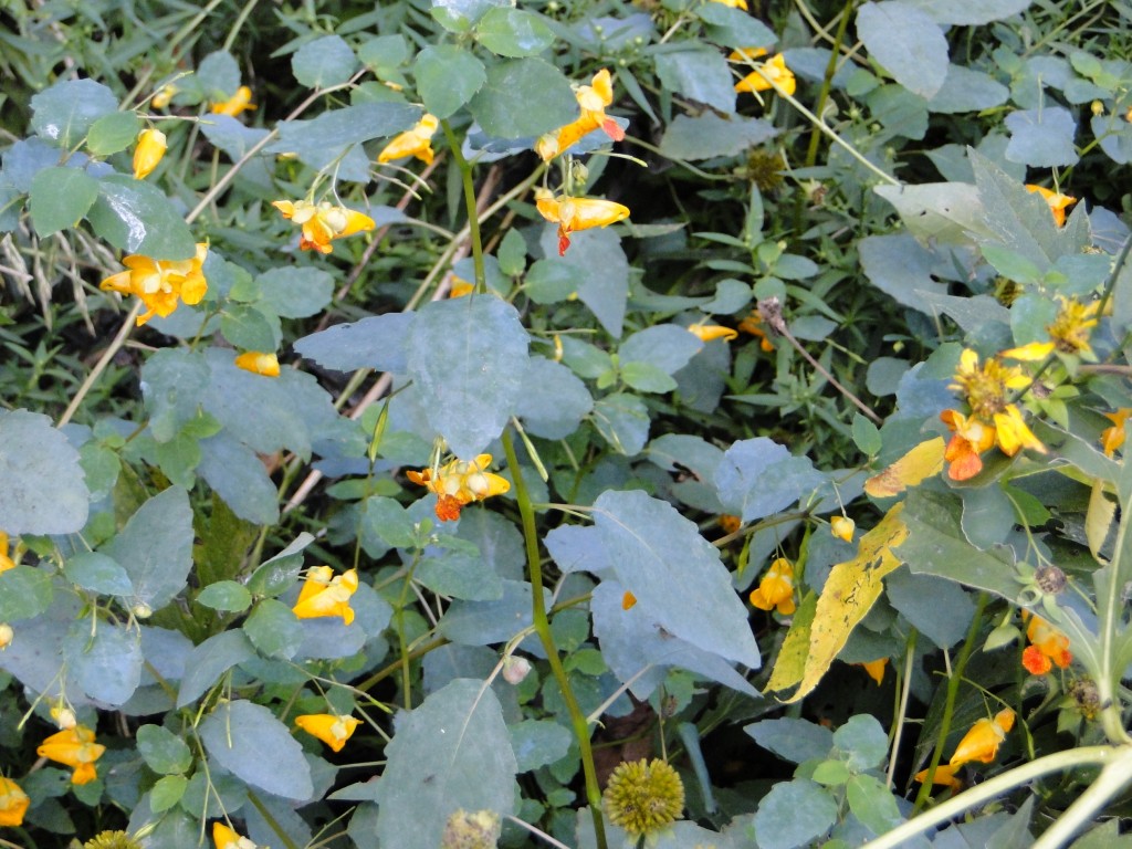
The dominant understory vegetation in a “rich” floodplain of a large river is also thick and lush, mostly annuals like jewelweed and false nettle, though flooding and ice, not plowing excludes perennials.  Frequent deposits of fresh silt and organic matter provide an abundant supply of the three, basic common  nutrients. Especially if the watershed has traprock ridges, alluvial soil is also rich in other minerals like calcium, magnesium, and manganese, and subacidic.

Such  soil is well-suited to late-season farming.   It also can support uncommon, minerotrophic (mineral-loving)  plants, where growing space and light is available. Floodplain annuals start growing only after floodwaters  recede, and tree falls and thick deposits of sediment often  open up new bare soil patches.

Jewelweed is dominant in alluvial soil with shale gravel, along Stocking Brook , in southwestern Berlin, Connecticut.

I have found delicate wildflowers only in early spring, before they are shaded by the rank annuals.  Dutchman’s Breeches (Dicentra cucullaria)  and spring beauty (Claytonia virginica) do grow on the banks of the Farmington River in Simsbury, with much traprock in its watershed. I also know a few rare floodplain sedges, like Davis sedge (Carex davisii),  with a vigorous,  tall growth form,  that can compete with the dense floodplain annuals – though not invasive shrubs like Euonymus alata.  Do  these uncommon floodplain plants need soil with high concentrations of minerals, with or without high availability of nitrogen, phosphorus and potassium?  Has any  research on this been published?

Base of a hillside

Another  place to find  “rich site” wildflowers, ferns  and sedges  in Connecticut is  the base of  a  hillside, among the boulders. Soil water at the base of a hill has been seeping slowly  downhill for hundreds of feet,and for many centuries,  dissolving minerals from the surfaces of soil particles and rocks. Topsoil has  also slowly washed downhill over the centuries. Slope-base soil  typically  has ample minerals and enough of the three basic nutrients, and is moist as well.  Stately bottomland trees grow in this rich, rocky soil:  sugar maple, red oak,  tulip poplar,  ironwood, and occasional basswood.   Spring ephemerals like red trillium (Trillium erectum) , bloodroot,  and trout lily  (Erythronium americanum) do most of their growing  before the trees leaf out.  However, some shade-tolerant minerotrophic plants  can keep growing  through the summer, like red elderberry and  broad beech fern – and other much rarer ones, like Goldie’s fern (which I have yet to find.)   The  understory is  less dense than in the floodplain, with less competition, and greater diversity. It still rankles me that a Target big box store was built  in this habitat at the base of a Meriden traprock cliff, without any ecological survey beforehand. It was over ten years ago, but I still boycott the store!

At the base of very long  seepage hillsides, soil water has the highest mineral concentrations,  and the slope-base plant community is potentially most diverse. The reason is simple, as I was taught by my major professor Ton Damman: the further the groundwater travels, the more minerals are dissolved.  I  recall an amazingly diverse  swamp at the base of a great hill in Winsted, Connecticut, west of Route 8.  We measured the nitrogen  levels, and they were quite low. Vegetation was low in density and stature, however, not a rank, impenetrable  thicket.  This allowed diverse, minerotrophic plants to coexist, including  melicgrass (Glyceria melicaria), chestnut sedge (Carex brunnensis), and a dwarf raspberry called Rubus pubescens.

Rocky Outcroppings

This year I  found these same plant species – and also Dutchman’s breeches  – on several  shale outcrops  in the  East Berlin geologic formation.  The laminated  shale rock structure increases surface area available for mineral dissolution. Positively charged cations (e.g. calcium and magnesium)  enter the soil water and increase the pH.  Subacidic soils derived from traprock, limestone, or shale  have the highest mineral levels, and  support diverse and interesting  plant communities.  Minerotrophic   plants are most likely in areas with subacidic soils, in large part because higher pH makes minerals more available to plants.  (This is the reason that farmers apply lime.)

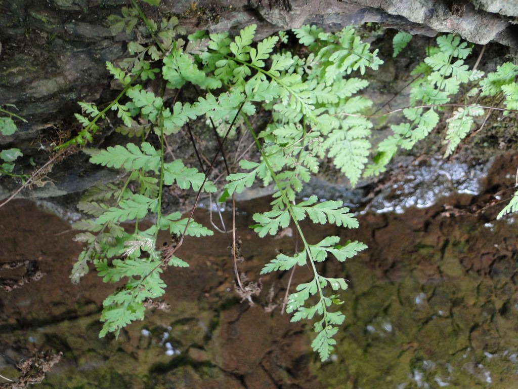
Brittle fern, an uncommon minerotrophic species of rocky habitats is growing out of a shale rock face along an incised stream , Stocking Brook in Berlin, Connecticut.

Characteristic plant species, uncommon  in other habitats, as well as truly rare, state-listed species,   are also often associated with  ledges, outcroppings, and  crevices of  rock formations, regardless of bedrock type. Botanizing is always rewarding in such habitats! I often find red columbine (Aquilegia canadensis) on traprock summits,  but sometimes also in areas with  a metamorphic  outcrop of gneiss or schist.     Dwarf saxifrage, Dutchman’s Breeches, Canada moonseed (Menispermum canadense), and red elderberry (Sambucus racemosa), and brittle fern  grow at the base of a low traprock cliff  near Kensington Road in Berlin.  The first four species I  often see in  undisturbed trap habitats, but rarely elsewhere.  The brittlefern (Cystopteris  fragilis) is rarer, but less tied to traprock.  The only orange-fruited horse gentian (Triosteum aurantiacum)   I have ever seen was at the base  of  a sandstone shale rock face, but they have also been found on coastal bedrock outcrops in Branford.  Rare prickly pears  (Opuntia humifusa) have been found in Old Saybrook on bedrock outcrops on “The Preserve” property; this is  probably because the open, southern exposure mimics the warmer growing conditions at the center of its range., and may – or may not – be also related to mineral-rich soil.

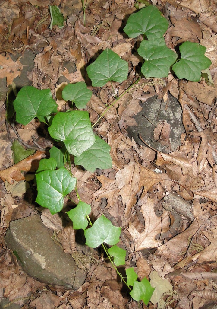
Seedling of a Canada moonseed vine, in moist, rich soil at the base of a basalt rock face; north end of Cathole Mountain, Kensington Road, Berlin.


Questions

The term minerotrophic is widely used, but solid data is lacking as to exactly which minerals are needed by which plant species, and at what levels.  What are the relative roles of microclimate and soil mineral needs, as they affect plant  distributions on rocky summits and outcrops?    How often is the distribution of a “rich site”  species limited, not by soil composition, but rather  by competition with other plants?   Many  uncommon plants are known to be characteristic of rocky habitats.  How often is this  due to the role of rocks and boulders in reducing competition, rather than mineral availability?  To what extent are “rich site” plants found along slope bases or on “rocky site” plants on summits because  the areas were historically too bouldery for farming, so that the plants remain there, but were long since eliminated elsewhere by  agriculture?   A telling comparison is the nearly pristine, and botanically diverse, forested  north slope of the traprock ridge at Dinosaur State Park, versus the depauperate east slope, which has been farmed for over a century.  Parts of this this field  are  infested by invasive Japanese barberry and burning bush, and the dominant ground cover is the prickly dewberry, a very common dry-site plant.  But even this field, also supports populations of uncommon plants  like Carolina rose and panicled bush clover, growing in sweet (subacidic), mineral-rich soil with traprock near the surface.

These are opportunities  for interesting ecological research!  We really have not advanced very much past the “rich site”  or “rocky site”  habitat  characterizations in the old botany manuals.


Transplanting Soil Blocks, a Biodiversity Rescue Tool

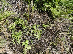
Several other state-wide rare plants are common in this former cranberry bog.

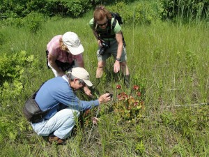
This past Spring (May and June 2012) a group in south central Connecticut transplanted many blocks of peat soil, about 20″ X 20″, with very rare Adder’s Tongue Fern (Ophioglossum pusillum).  This is  an attempt to salvage the population from an area that is to become an active cranberry bog again, after many years of lying fallow except for mowing. The soil and vegetation blocks also contained the rest of the ecological community:  royal fern, assorted sedges, rushes, and wildflowers, countless microorganisms,  invertebrates,  and –  not to be forgotten –  a seed bank. Watering and monitoring continues.

The destination area was  closer to the road, also former cranberry bog, but still fallow. When choosing a location to place a block, great care was taken to replicate hydrology and aspect, though peat depth could not be replicated; the organic horizon was substantially deeper in the source area.  It took over 100 man-hours of back-breaking labor by Carol Lemmon, a Board Member of the Connecticut Botanical Society,   and half a dozen others (mostly volunteers)  to move the population from the future cranberry cultivation area.

Maintaining the former cranberry bog as a wet meadow, rather than letting it revert to a red maple forest, requires regular  mowing.  Meadow, as a wildlife habitat, is in much shorter supply in Connecticut than forest.  Phragmites australis control was also needed. This invasive would have completely overrun the entire diverse botanical community without expensive eradication. Fortunately with multiple rare and uncommon species, including several species of gorgeous  pink orchids, funds have been found for  the aspects of rescue, maintenance,  and restoration  that need paid skilled workers.  The biodiversty and beauty of the unusual peatland wet meadow  motivate volunteers to  donate  most of the man and woman power for execution of the rescue operation, as well as restoration and ongoing maintenance.

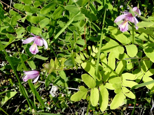
The Connecticut Threatened Adder’s Tongue has a simple, ovate leaf with a pointed tip, entire leaf edges (no teeth,) and is only abut two inches long.  Its flower is a plain green spike, rather like a plantain flower. Adder’s Tongue looks for all the world like a Canada Mayflower leaf with a plantain flower.  The photos below include  a transplanted block with a few such leaves.  For a clearer image, just google the scientific name. Blooming Pitcher Plant and some Rose Pogonia orchids are also shown.

I apologize for not including the location of this worthy project, quite likely to succeed, but it is CTDEEP policy not to divulge locations of rare species, for their future safety.

Ambitious rescue operation for one of the last populations of a Connecticut-Threatened plant species
A population of CT Threatened Adder’s Tongue was transplanted, soil block by soil block into this wet meadow, from another nearby boggy wet meadow, soon to become a commercial cranberry bog again.

Trace Minerals & Toxins: GMO Concerns

Why does food grown organically seem to taste better than conventionally grown food. Is this my imagination or due to some real difference? I read that levels of trace minerals (micro-nutrients) were usually lower in non-organic food. This makes sense for hydroponic foods, but why should conventional agribusiness crops have lover levels of trace minerals?

Truthfully, I’ve been somewhat sceptical about health and safety risks from GMO (genetically modified organism) crops? Inserting genes for disease resistance does seem sensible. The Environment Committee of the Connecticut Legislature happens to be reviewing a bill (HB 5117) that would require labeling all such food, so I read Hearing testimony and did some research.

A recognized concern, from a health and environmental standpoint, is the gene that has been spliced into crop plants, for a persistent bacterial toxin (from BT or Bacillus thuringensis). This toxin is now found in the blood of the majority of American women. It is a natural pesticide that attacks cell membranes – not just in the target pest caterpillars, but also membranes in rats and potentially in humans, especially fetuses. However, I did not see any data on toxin concentrations, and information on threshold concentrations for harmful effects is sorely lacking.

Analysis of potential impacts on adjacent ecosystem biodiversity from BT GMO crops has also been wholly inadequate. How will populations of economically insignificant species of caterpillars, moths and butterflies -and their predators- be affected by feeding on leaves and pollen from GMO plants along field edges? Ill effects on migrating monarch butterflies were in the news last year.

I see even less less public concern with the largest category of GMO crops: those with an inserted gene that makes them “Roundup Ready”, able to tolerate its active herbicide ingredient, glyphosate, although application rates must be cranked up several fold. Interference with uptake of micro-nutrients by glyphosate was studied in Stuttgart, Germany, at the University of Hohenheim, over ten years ago. German researchers warned us that mineral-deficient plants would be more susceptible to soil fungal diseases; this is now well documented for many fungal diseases – most recently widespread Fusarium wilt in GMO Roundup Ready soybeans in the southern US. The Stuttgart scientists found two causes of the problem: 1) glyphosate firmly latches (chelates) onto soil trace minerals, making them unavailable and 2) it eliminates or suppresses soil microbes and invertebrates. These include beneficial mycorhizal fungi) which help the plant extract soil nutrients (trace minerals included), and earthworms, springtails, isopods and man other soil organisms that recycle nutrients from plant debris into soil (trace minerals included). [As glyphosate is only one of many agrichemicals that suppress populations of soil organisms, my first question was answered; I can now see a scientific basis for lower levels of trace minerals in non-organically raised foods!

Because Roundup application rates increase sharply when GMO Roundup Ready crops are planted, this micro-nutrient problem has become more severe. Scientists at several US midwestern universities followed the lead of the Stuttgart researchers, including Don Huber at Purdue in Illinois, Barney Gordon in Kansas, and Kurt Thelan in Michigan. They have continued to investigate the trace mineral deficiencies, particularly manganese, but also zinc and others, that are an unwelcome side-effect of Roundup use (glyphosate). [The URL of a review article is http://www.environment.co.za/gm-foods-crops-biofuels-pesticides/missing-micronutrients-glyphosate.html. It was posted out of Western Illinois University by Enviroadmin on Sunday, 23 May 2010.}

It is now also known that the inserted gene in GMO Roundup Ready soybeans interferes with production of a root secretion that solubilizes minor mineral nutrients. (This is in addition to glyphosate directly chelating micro-nutrients, and suppressing or killing beneficial soil microbes and invertebrates.) Attempts to cope with the problem by fertilizing GMO Roundup Ready crops with heavy dosages of micro-nutrients have been challenged by the chelating (tight-attaching) properties of glyphosate. Similarly, human assimilation of mineral supplements in pill form is usually poor, unless the dietary supplements are bulky and food-derived! I, for one, balk at swallowing horse pills three times a day.

Nor has there been adequate analysis of the impacts on surrounding ecosystems of expanded Roundup use on Roundup Ready GMO crops. How much has it reduced the extent of field edge buffers with grass and forb (“weed”) seeds that used to be available for songbirds? Such buffer strips between and around fields are still available in a sustainably managed organic farm. More and more weeds are evolving resistance to to glyphosate; the response is accelerated efforts to develop GMO crops resistant to other herbicides, that have their own suites of risks and side-effects – which will also not be adequately tested as this is not yet required by EPA.

I can envision genetic modification for the purpose of inserting blight resistant genes from related plant species or perhaps to improve crop quality, but only after far more rigorous testing than is the current practice – directed by a third party entity (not Monsanto Corporation testing its own GMO crops!). But inserting genes for herbicide tolerance – or insecticidal proteins – seems fundamentally unwise. Expansion of organic agriculture is important for the human diet as well as for the surrounding natural environment; not just to avoid possible pesticide residues, but perhaps more importantly, for the sake of nutritional quality.

A version of this post was sent to several Connecticut members of the Environment Committee, and published by CT NOFA (Northeast Organic Farming Association)

Link: http://environmentalheadlines.com/ct/2012/03/18/a-letter-to-ct-nofa-folks-from-a-farmer/


Water Woes on Drumlins

What is a drumlin anyway?  A gremlin with an aptitude for percussion?   Seriously, a rounded, elongated hill in the Connecticut landscape is probably a “drumlin”. The best known is Horsebarn Hill on the eastern side of the UConn campus at Storrs. Landing Hill in East Haddam was  in the local limelight several years ago. Lately I’ve been working on Meetinghouse Hill and Misery Hill in Franklin.  The Goshen Wildlife Management Area is another. The word “drumlin” comes from Ireland, where this land form also occurs.

The core of a drumlin hill is fine-textured, compact glacial debris, though bedrock may be underneath, poking through in a few places.   The compact “hardpan” layer (in common parlance)  may be over 100 feet thick, and dates from the prior Illinoisan glaciation (over 128,000 thousand years ago). Only the top layer, usually just a few feet deep, is sandier, looser soil, formed from the melting ice masses of the more recent Wisconsin glaciation, underlain by the compact till (scientists’ terminology).

These soils are seasonally wet.  Though the level summits seem, at first glance, to be well-suited to community development, they are challenging to develop, whether on drumlins or elsewhere, such as plastered onto the sides of traprock ridges. Most gently sloping drumlin hilltops in New England used to be productive hayfields, growing lushly in spring when soil moisture was available, going dormant in mid summer.  Pockets of wet meadow were rich in flowers, like New England Aster. Drumlin fields make fine hunting territories for raptors like barred owl.

Colorful wet meadow perched on top of drumlin.

Multiple seasonal seepage wetlands and headwaters streams flow down drumlin hillsides. They are a valuable source of clean water for the drainage basin if the drumlin is undeveloped, they but may become conduits for construction runoff.

There is more groundwater discharge on the nearly level sections of drumlin hillsides than on the steep sections. These are also prone to septic breakout.

Only a small percentage of Connecticut’s soils are compact tills but a disproportionate share of construction site fiascos and problem-plagued new subdivisions occur on hardpan soils. Wet, silty, sticky  hardpan  soils, on drumlins and also in other landscape settings,  can become a mire for heavy construction equipment because the snowmelt and spring rains “perch” on top of the hardpan. Saturated silty soils are highly erosive,  often an erosion control nightmare. Flooding problems are more severe than on absorbent soils, and water pollution from lawns and septic systems becomes a problem at lower home densities.  Break-out from home septic systems happens more often.

Typical complaints of drumlin residents: wet and moldy basements, icy sidewalks;  soggy, fungus-infested grass, burned-out grass, and dying shade trees; extended sump pump operation (not energy efficient), mosquitoes, and septic odors; and polluted down-gradient ponds.  These all become more of an issue for seasonally wet, drumlin soils, because more water stays at the surface, as it cannot soak into dense hardpan soil. (Runoff coefficients are higher, in engineering jargon.)

With careful home and septic system placement, curtain drains, and appropriate landscaping, one can avoid some of these problems – but only if home densities are relatively low.

Ironically, the loose upper soil layer of a drumlin is usually so shallow that it holds little reserve water during dry spells, so drumlin lawns need much irrigation in summer, though excess water is the problem in other seasons.   Solutions: small lawns, partially wooded yards, and/or a meadow landscape with drought-tolerant grasses like Little Blue Stem, a.k.a. Poverty Grass.

A Plea for Guidance

Could  CTDEEP and our Conservation Districts provide land use boards, planners, and developers  with more guidance on drumlins’  multiple constraints?  On-line mapping (Web Soil Survey or WSS) available from the Natural Resource Conservation Service (NRCS) does show the approximate locations of seasonally wet, hardpan soil units, like the Paxton, Woodbridge, and Wethersfield soil series.

More guidance is needed to make sure fertilizers and pesticides are not applied before or after heavy rains.  This happens all the time in Connecticut suburbs!  Turf chemicals tend to run off drumlin soils, more than off more absorbent soil types, especially when the soils are already soggy.

Few understand that watercourse setbacks often need to be wider and  septic system densities need to be lower on compact till soils, to protect down gradient wells, headwaters streams, pools, and lakes from excessive nitrogen,  in nitrogen enriched groundwater and runoff. Because they reduce lot yields, these constraints need  explanation in an official DEEP guidance document, preferably also in a  CT Health Department memorandum!

Clear-cutting may seem to be  more economical for the developer, who should be warned that this is not wise on a drumlin!  To minimize future “water woes”,   maximize  remaining tree cover when subdivisions are built. The reason is two-fold: 1) to slow the velocity of the falling rain, and 2) because trees spew thousands of gallons of water into the air as water vapor (transpiration), helping dry out those surface soils.  After clear-cutting, a drumlin hillside that used to be wet only in March and April may stay wet to the surface though June – and before long, one will see the tell-tale mottles and grayish matrix color of a jurisdictional Connecticut wetland soil.

Some, but not all engineers use underdrains and clay stops  to prevent frost heave damage to roads and utility pipes, and to allow shallow groundwater to continue to seep down slope to wetlands that depend on this water source – instead of being shunted along  roadbeds and sewer lines.  Guidance is also needed in this area.

Once aware of drumlins’ constraints and resources, town  zoning boards  will be able to  guide development more appropriately,  protecting valuable vernal pools and hillside streams, and at least a portion of the productive forests. For expansive overgrown fields on flat-topped drumlins, if the alternatives of farmland or grassland wildlife habitat are not possible, at least the damage to down-gradient headwaters resources,  from a  low density, large-lot residential community, with small lawns,  will be  much less than from a large, dense subdivision.

(First version of blog posted on 9-6-08)

Origins of the Traprock Ridges

The extensive ridgetop hiking trails in central Connecticut are fairly well known, with their fine views, blueberries, and sunflowers, e.g the trails on East Rock, West Rock, Mount Higby, the Hanging Hills,  Cathole Mountain, and Ragged Mountain.  However, remarkably few people who live here realize that the Metacomet and other ridges are  of volcanic origin.  Why isn’t this  part of every high school earth science  class? The geologic processes described below have created a rugged landscape with mineral-rich, subacidic soil,  steep talus slopes (fields of basalt chunks), cliffs, and exposed rock outcrops;  these are all habitats for unusual flora and fauna, including rare species – another fact that is not widely known.

View from the southwest of Cathole Mountain (south end of the ridge, in  Meriden)

Connecticut does not have cone-shaped mountains that once rumbled and spewed ash and lava. Instead the lava oozed more slowly from deep, elongated cracks, that started forming 200,000 years ago, when  the supercontinent, Pangaia, began to pull apart.  Tension between the freshly separated continents caused two elongated cracks (faults) to form. The land settled between two deepening faults, creating a rift valley.  Molten lava oozed up through the deepest cracks and spread across the valley, and then cooled and hardened into traprock (basalt). Three separate periods of lava flows formed three beds of variable thickness.  The middle bed (Holyoke Basalt) may be hundreds of feet thick.

The valley gradually filled with sediment eroded from what used to be high mountains in eastern and western Connecticut. The eastern and western highlands are still many hundreds of feet higher in elevation than the lowlands of the Connecticut valley.  Each successive bed of basalt (cooled lava) was buried by sediment that was compressed into a reddish-brown sedimentary rock, known as brownstone or New Haven Arkose. Total deposition was two miles thick at the Eastern Border Fault in Middletown.  Climate conditions at that time were tropical, which accounts for the red, oxidized color of the sedimentary rock and its low mineral content.[1]

Because the rift valley was still deepening along the Eastern Border Fault (often called the “trapdoor”), the rock beds all tilted down to the east, by 15 to 25 degrees.  The broad basalt beds were glued together by sedimentary brownstone.  Eventually the beds  broke apart into multiple, tilted  “sandwich” chunks.  Over time, especially during the periods of glaciation, the  process of erosion exposed the higher, western, “up-tipped” edges of the these basalt beds, since  traprock is considerably harder than brownstone. The sedimentary“glue” weathered away between the layers of basalt rock. The western edge of each broad basalt slab became a basalt ridge.  A traprock ridge  typically has cliffs and steep talus fields on the west side, and a gently sloping eastern slope,  corresponding to the original easterly tilt of the rock formation.

 The ridges often show an interesting triplet pattern: a central taller ridge corresponding to the thick bed of Holyoke Basalt, is flanked by two much lower parallel ridges, corresponding to the thin slabs of Talcott and Hampden Basalts).  The far north end of Cathole Ridge shows this pattern very clearly.

Most of our  traprock ridges originated as described above, from the western edges of cracked, tilted  lava slabs. However, some “intrusive” formations like Sleeping Giant and West Rock[2] were formed underground. The oozing lava cooled slowly underground, rather than on the surface. In this slow-cooled rock, called diabase, crystals are larger and visible to the naked eye. The  rock weathers more slowly, but mineral composition is identical to basalt. These intrusive ridges were buried by sediment and then exposed by weathering and glacial scour, just like the basalt ridges.

Central Connecticut’s  continuous, above-ground traprock ridge system extends northerly into Massachusetts, but cracks in the rift valley oozed lava as far north as Newfoundland.  Intermittently exposed basalt also occurs in Newark and Hoboken, New Jersey (the Palisades) and further west in the Pomperaug valley in Southbury and Woodbury, Connecticut.

The sub-acidic, volcanic soil on traprock ridges is fine-textured and less acid and richer in minerals, like calcium, magnesium, and potassium- than soil derived from brownstone, granite, gneiss or schist.  Second, the thin soil, rocky outcrops, talus,  boulder fields, and steep slopes are specialized ecological conditions quite different than that found in lowland forest, and are associated with a unique suite of plants and animals.

Partly open glades are characteristic, The “lawn” is actually Pennsylvania sedge, which remains low, naturally. A characteristic suite of plants (besides Penn Sedge) grows in this habitat.
These ecological communities have been designated  as high priority “critical habitats”  by CTDEEP.  However, like  the low public awareness of the ridges’ unusual volcanic origins, public awareness of the traprock ridges’ high conservation value seems surprisingly low, even in the towns where the ridges are major landscape features, like Meriden, Berlin, Cheshire, and New Haven.

Footnotes

[1] An infertile “tropical” soil with a reddish color forms from brownstone parent material unless it is enriched by basalt glacial till or by river sediment.   The well weathered soils of the tropics are also known for their red color.

[2] The name of West Rock (in West Haven and Hamden) changes moving northward, first to Prospect Ridge,  and then to Peck Mountain in North Cheshire.

Photos of the five critical traprock habitats  may be viewed via links to public facebook albums (Sigrun Gadwa).

  • album1    West Peak Summit in September – CT Botanical Society Excursion
  • album2    Traprock Ridge Natural Resources of Central Connecticut
  • album 3   Wetlands Below Traprock Ridges
  • album 4   North end of Mount Lamentation
Symphiotrichum laevis is a spectacular, densely flowering, dry-site aster found on traprock summits.


Ailing from Indoor Air Pollution? Go Outside!

This afternoon I heard on public radio (Faith Middleton Show) that  health problems from indoor air pollution are worst in the most energy efficient, air-tight homes (LEED- certified).  I also heard that on average Americans spend less than 95% of their waking day indoors. The Yale PHD interviewed praised his own leaky windows, for the healthy outdoor air they let into his house. (Research was done by Environment and Human Health, Inc. )

This is a very real problem, a major contributor to childhood asthma.  I have heard that it can be addressed without squandering energy by systems of ventilation that include heat exchangers – and by choosing building and decorating materials for minimal off-gassing- like wool rugs – or straw mats, rather than synthetic carpet with backings and  adhesives that generate unhealthy gasses.  It would be great for sustainable farmers to have a stronger market for sheep wool! Faith Middleton pointed out that better labeling of materials is needed, so that homeowners and contractors can make informed choices.

If structural changes are not possible in the short term, it helps to periodically open multiple windows to air the house, on warmer days in winter, and to spend more time outdoors.  My mother did not give me and my siblings a choice; we were sent outside to play and did indeed find interesting things to do.   A diverse natural environment with some wildlife, insect life, and wildflowers will hold your childrens’ interest longer!  Obviously we  breath fresh air while hiking and walking the dog.

Consider also that time spent working in the yard, is time breathing healthier air- typically also with less dust and mold spores than indoor air.  Pulling out lawn weeds, trimming bushes and raking weeds by hand is more time consuming than using power -tools.  It seems to me that the yard would be more inviting to many adults, with greater variety of plantings – and self-seeded plants –  native and non-native,  to keep track of and tend. My husband is not a trained horticulturalist or ecologist, but enjoys spending time outside with me, following my lead, and listening and learning as I point things out.  He now is able to recognize and mow around attractive native perennials – like buttercups and daisies – that crop up in the lawn, even before they bloom!

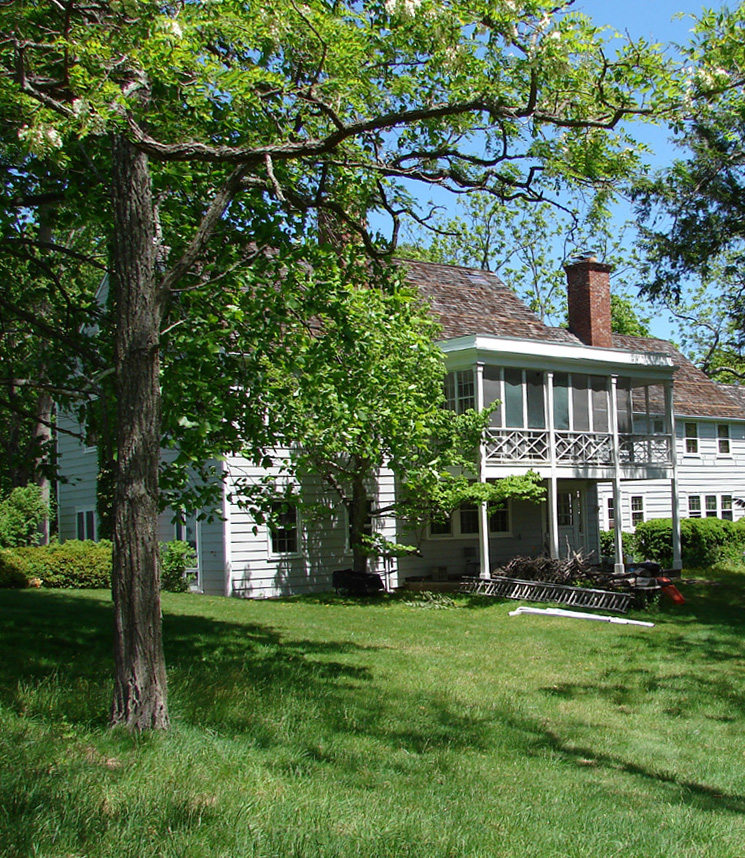
The outdoors is also more welcoming in summer,  if indoor and outdoor temperatures are similar. At our house in Cheshire, Connecticut, in lieu of air conditioning,  we use airflow drafts though open windows and screened doors, and  shade from an “umbrella” catalpa tree (pruned each fall) on the south side of the house.  Our extended family’s vacation house on Long Island is shaded to the south by two large hemlocks.  It has a long, narrow shape with many windows on both sides, allowing  for excellent cross ventilition. A screened second floor sleeping porch sleeps up to five (on cots) and is a pleasant place to spend time (read, sleep, or just rest and listen to the birds outside)  even in very hot, humid summer weather,  typical of Long Island.

Tomorrow, June 12th,  is the birthday of my brother, who believes lots of  work and play outdoors is the key to good health. We’ll be touring three demonstration alternative “organic” lawns in Newton, Massachusetts (Ecological Landscaping Assoc. http://www.ecolandscaping.org/), one with a solar house.   I expect to learn more ways to spend time outside on my piece of land, and have a fine-looking, dog-safe and wildlife-friendly, “organically ”  landscaped property – fodder for a future blog post. One way I know from childhood is to welcome black locust trees* and clover, which take nitrogen out of the air, by means of symbiotic rhizobium bacteria – free fertilizer! See photo below.

Sleeping porch: comfortable on hot LI nights- and days- in a pre-airconditioning house

*Black locust is on the invasive species lists of some states. It can spread aggressively, fertilize, and change,  sandy infertile natural habitats, as on the Cape in Massachusetts, but in a home landscape , in a pasture, or as a street tree, it is just fine, in my opinion (and that of other Long Island “natural resource professionals” and farmers).  Its abundant nectar is valuable for bees. Black locust  is in fact native to the US –  is from further south and west than Long Island and southern New England.

Turtle Hibernation Habitat? Soils Data Needed

It would be very helpful to consulting ecologists like me, if more information were available on the characteristics of habitats (soil textures, canopy cover, moisture levels, depths, slope aspects) that are used for hibernation and nesting of the various turtle species in this region. Good southern New England data is available for the endangered bog turtle, but not for the other declining species, such as Eastern box turtle, wood turtle, and spotted turtle, or for common species like painted turtle, musk turtle, and snapping turtle.  This would help land planning professionals make recommendations, such that development and roadway projects and residential improvements could better avoid these habitats, or at least mitigate for the habitat loss by creating similar habitat nearby.

Eastern Box Turtles (Terrapene c. carolina) must hibernate on land, in locations where they will neither be frozen, nor suffocate due to inadequate oxygen.  Even in a torpid state, with slow metabolism, they do need some oxygen.  Developing turtle eggs also need some oxygen.

In Connecticut, E. Box Turtles are missing from the northwestern Litchfield County Hills, where temperatures are cooler and where very shallow, rocky soils are common. The elevational maximum is 700 feet, according to our state’s principal reference book for turtles, Dr. Michael Klemens’  Amphibians and Reptiles of Connecticut and Adjacent Regions, 1993, CTDEP Bulletin No. 112.   E. Box Turtles (EBT’s) are more common in the southern U.S., compared to southern New England and New York State; likely due to less mortality during hibernation. That may be why human poisoning by sequestered mushroom toxins has been reported during strikes among southern Appalachian, but not Pennsylvania coal miners.

In my experience, soil scientists and others do most often find Eastern Box Turtles in the vicinity of relatively coarse-textured soils.  We have found them repeatedly in the deep, coarse-textured (sandy) outwash plains near rivers; also in Long Island and Connecticut Central valley farmland with deep soils.  These soils have a high proportion of pore spaces and, accordingly more available oxygen than fine-textured soils.  They are also easy to dig.  However, I am not aware of solid soils data for actual hibernation and nesting sites in deep coarse or coarse-loamy soils in our region. .

Much of southern New England and adjacent New York state has stony, till-derived soils, often fine textured, shallow to bedrock, or with a hardpan.   E. box turtles may also still locally common in these areas, in East Hampton, CT and Haddam Neck, CT, for example.  In a till-dominated landscape, deep, organic-rich soils bordering forested seasonal wetlands are likely used for hibernation.  Dr. Klemens knows of data, showing soils on wetland perimeters being used in a stony till landscape  in Southeastern New York State (personal communication).  Rotten stumps and logs are another EBT hibernation solution reported by various southern turtle researchers (in summary chapters in books by Ernst and Dodd) and also by graduate students at Central Connecticut State Univ., studying a population on the slope of a trap rock ridge in southern CT.

Friable soils are not only well suited for hibernation, on land, for the terrestrial Eastern Box Turtle, but also for nest-digging by several other  Connecticut turtle species.  A southern or western exposure would seem more important for a nesting site than a hibernation site, but data on slope orientation of both hibernation and nesting sites is sorely lacking.   Most of the above is based on informal observations or a single study. Solid soils and landscape data, with accompanying basic turtle data, is needed to accurately document habitat characteristics of nesting and hibernation sites!